|
Paparazzi UAS v7.1_unstable
Paparazzi is a free software Unmanned Aircraft System.
|
|
Paparazzi UAS v7.1_unstable
Paparazzi is a free software Unmanned Aircraft System.
|
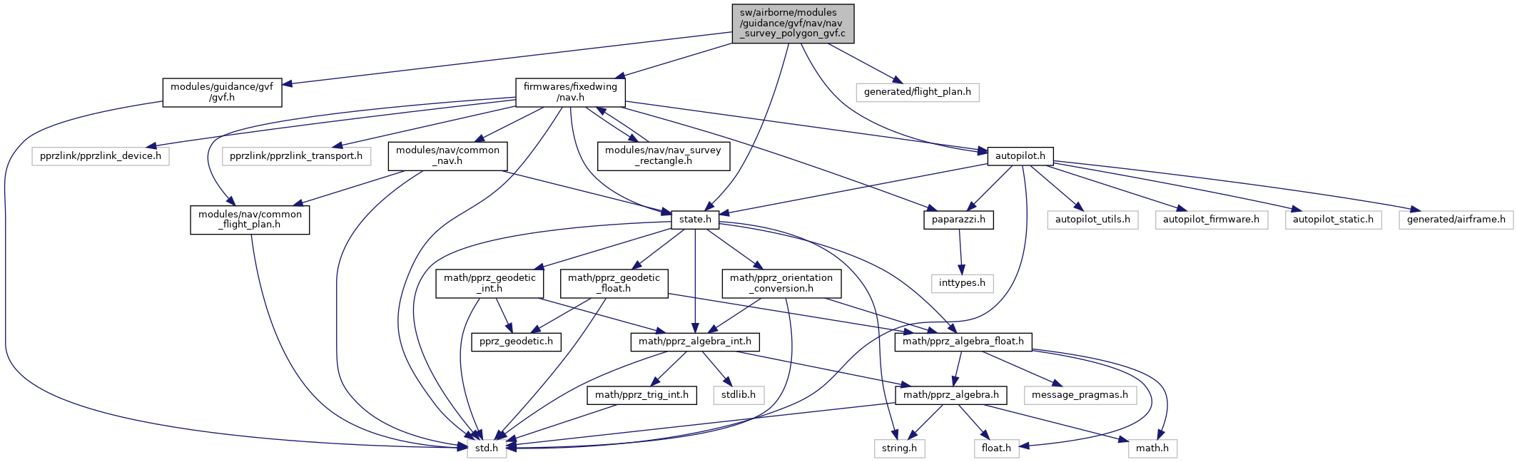
#include "nav_survey_polygon_gvf.h"#include "firmwares/fixedwing/nav.h"#include "state.h"#include "autopilot.h"#include "generated/flight_plan.h"#include "modules/guidance/gvf/gvf.h" Include dependency graph for nav_survey_polygon_gvf.c:
Go to the source code of this file.
Functions | |
| static void | gvf_circle_direction (float rad) |
| static bool | gvf_intercept_two_lines (struct FloatVect2 *p, struct FloatVect2 x, struct FloatVect2 y, float a1, float a2, float b1, float b2) |
| Intercept two lines and give back the point of intersection. | |
| static bool | gvf_get_two_intersects (struct FloatVect2 *x, struct FloatVect2 *y, struct FloatVect2 a, struct FloatVect2 b) |
| Intersects a line with the polygon and gives back the two intersection points. | |
| void | nav_gvf_survey_polygon_setup (uint8_t first_wp, uint8_t size, float angle, float sweep_width, float shot_dist, float min_rad, float altitude) |
| Initializes the variables needed for the survey to start. | |
| bool | nav_gvf_survey_polygon_run (void) |
| Main navigation routine. | |
Variables | |
| struct gvf_SurveyPolyAdv | gvf_survey |
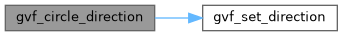
Definition at line 46 of file nav_survey_polygon_gvf.c.
References gvf_set_direction().
Referenced by nav_gvf_survey_polygon_run().
Here is the call graph for this function: Here is the caller graph for this function:
|
static |
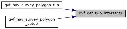
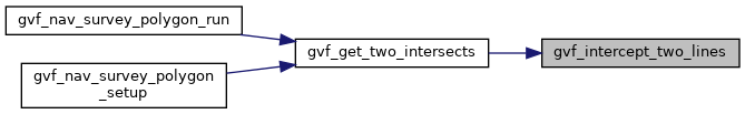
Intersects a line with the polygon and gives back the two intersection points.
| x,y | intersection points |
| a,b | define the line to intersection |
Definition at line 86 of file nav_survey_polygon_gvf.c.
References b, gvf_SurveyPolyAdv::dir_vec, foo, gvf_intercept_two_lines(), gvf_survey, gvf_SurveyPolyAdv::poly_count, gvf_SurveyPolyAdv::poly_first, waypoints, FloatVect2::x, point::x, FloatVect2::y, and point::y.
Referenced by nav_gvf_survey_polygon_run(), and nav_gvf_survey_polygon_setup().
Here is the call graph for this function: Here is the caller graph for this function:
|
static |
Intercept two lines and give back the point of intersection.
| p | returns intersection |
| x,y | first line is defined by point x and y (goes through this points) |
| a1,a2,b1,b2 | second line by coordinates a1/a2, b1/b2 |
Definition at line 63 of file nav_survey_polygon_gvf.c.
References foo, p, FloatVect2::x, and FloatVect2::y.
Referenced by gvf_get_two_intersects().
Here is the caller graph for this function:Main navigation routine.
This is called periodically evaluates the current Position and stage and navigates accordingly.
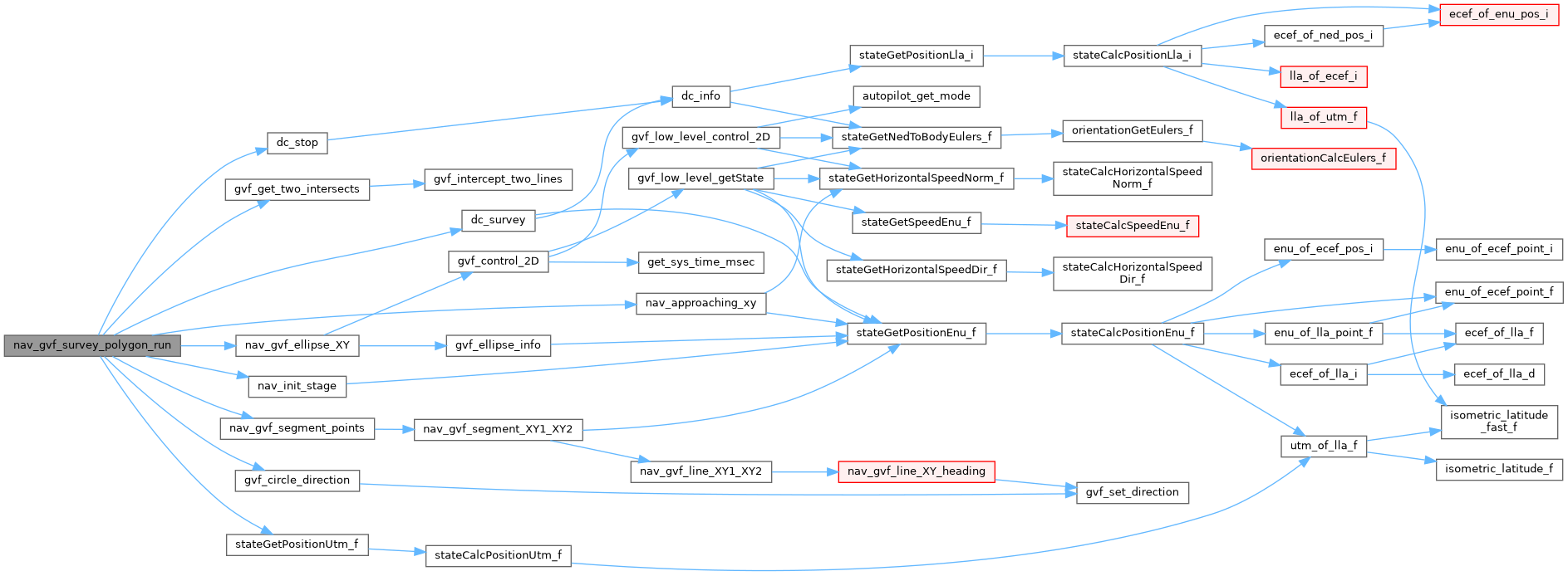
Definition at line 246 of file nav_survey_polygon_gvf.c.
References CARROT, dc_stop(), dc_survey(), gvf_SurveyPolyAdv::dir_vec, gvf_SurveyPolyAdv::entry_center, foo, gENTRY, gRET, gSEG, gTURN1, gTURN2, gvf_circle_direction(), gvf_get_two_intersects(), gvf_survey, last_x, last_y, nav_approaching_xy(), nav_gvf_ellipse_XY(), nav_gvf_segment_points(), nav_init_stage(), NavCourseCloseTo, NavVerticalAltitudeMode, NavVerticalAutoThrottleMode, gvf_SurveyPolyAdv::psa_altitude, gvf_SurveyPolyAdv::psa_min_rad, gvf_SurveyPolyAdv::psa_shot_dist, gvf_SurveyPolyAdv::psa_sweep_width, gvf_SurveyPolyAdv::rad_vec, gvf_SurveyPolyAdv::ret_end, gvf_SurveyPolyAdv::ret_start, gvf_SurveyPolyAdv::return_angle, gvf_SurveyPolyAdv::seg_center1, gvf_SurveyPolyAdv::seg_center2, gvf_SurveyPolyAdv::seg_end, gvf_SurveyPolyAdv::seg_start, gvf_SurveyPolyAdv::segment_angle, gvf_SurveyPolyAdv::stage, stateGetPositionUtm_f(), gvf_SurveyPolyAdv::sweep_vec, VECT2_DIFF, VECT2_SUM, FloatVect2::x, and FloatVect2::y.
Here is the call graph for this function:| void nav_gvf_survey_polygon_setup | ( | uint8_t | first_wp, |
| uint8_t | size, | ||
| float | angle, | ||
| float | sweep_width, | ||
| float | shot_dist, | ||
| float | min_rad, | ||
| float | altitude | ||
| ) |
Initializes the variables needed for the survey to start.
| first_wp | the first Waypoint of the polygon |
| size | the number of points that make up the polygon |
| angle | angle in which to do the flyovers |
| sweep_width | distance between the sweeps |
| shot_dist | distance between the shots |
| min_rad | minimal radius when navigating |
| altitude | the altitude that must be reached before the flyover starts |
Definition at line 145 of file nav_survey_polygon_gvf.c.
References altitude, gvf_SurveyPolyAdv::dir_vec, gvf_SurveyPolyAdv::entry_center, FLOAT_VECT2_NORMALIZE, foo, gENTRY, gERR, gvf_get_two_intersects(), gvf_survey, NavVerticalAltitudeMode, NavVerticalAutoThrottleMode, gvf_SurveyPolyAdv::poly_count, gvf_SurveyPolyAdv::poly_first, gvf_SurveyPolyAdv::psa_altitude, gvf_SurveyPolyAdv::psa_min_rad, gvf_SurveyPolyAdv::psa_shot_dist, gvf_SurveyPolyAdv::psa_sweep_width, gvf_SurveyPolyAdv::rad_vec, gvf_SurveyPolyAdv::return_angle, gvf_SurveyPolyAdv::seg_end, gvf_SurveyPolyAdv::seg_start, gvf_SurveyPolyAdv::segment_angle, gvf_SurveyPolyAdv::stage, sweep, gvf_SurveyPolyAdv::sweep_vec, VECT2_COPY, VECT2_DIFF, VECT2_SMUL, VECT2_SUM, waypoints, FloatVect2::x, point::x, FloatVect2::y, and point::y.
Here is the call graph for this function:| struct gvf_SurveyPolyAdv gvf_survey |
Definition at line 42 of file nav_survey_polygon_gvf.c.
Referenced by gvf_get_two_intersects(), nav_gvf_survey_polygon_run(), and nav_gvf_survey_polygon_setup().