|
Paparazzi UAS
v5.12_stable-4-g9b43e9b
Paparazzi is a free software Unmanned Aircraft System.
|
|
Paparazzi UAS
v5.12_stable-4-g9b43e9b
Paparazzi is a free software Unmanned Aircraft System.
|
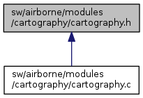
 This graph shows which files directly or indirectly include this file:
Go to the source code of this file.
Functions | |
| void | init_carto (void) |
| Automatic survey of an oriented rectangle (defined by three points) More... | |
| void | periodic_downlink_carto (void) |
| void | start_carto (void) |
| void | stop_carto (void) |
| bool | nav_survey_Inc_railnumberSinceBoot (void) |
| bool | nav_survey_Snapshoot (void) |
| bool | nav_survey_Snapshoot_Continu (void) |
| bool | nav_survey_StopSnapshoot (void) |
| bool | nav_survey_computefourth_corner (uint8_t wp1, uint8_t wp2, uint8_t wp3, uint8_t wp4) |
| bool | nav_survey_losange_carto_init (uint8_t wp1, uint8_t wp2, uint8_t wp3, float distrail, float distplus) |
| bool | nav_survey_losange_carto (void) |
Variables | |
| float | distrailinteractif |
| void init_carto | ( | void | ) |
Automatic survey of an oriented rectangle (defined by three points)
Definition at line 148 of file cartography.c.
Definition at line 211 of file cartography.c.
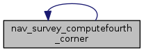
References nav_survey_computefourth_corner(), PRTDEB, PRTDEBSTR, waypoints, point::x, and point::y.
Referenced by nav_survey_computefourth_corner().
Here is the call graph for this function: Here is the caller graph for this function:| bool nav_survey_Inc_railnumberSinceBoot | ( | void | ) |
Definition at line 177 of file cartography.c.
References railnumberSinceBoot.
| bool nav_survey_losange_carto | ( | void | ) |
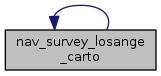
Definition at line 423 of file cartography.c.
References angle_between, camera_snapshot_image_number, circleradiusmin, course_next_rail, distancefromrail, DISTLIMIT, distplus, distrail, DISTXY, FALSE, nav_route_xy(), nav_survey_ComputeProjectionOnLine(), nav_survey_losange_carto(), NavCircleWaypoint, norm12, norm13, normAM, normBM, numberofrailtodo, pointC, ProjectionInsideLimitOfRail, PRTDEB, PRTDEBSTR, railnumber, railnumberSinceBoot, signforturn, stateGetHorizontalSpeedDir_f(), stateGetPositionEnu_f(), survey_losange_uturn, tempcircleradius, tempx, tempy, UTURN, vec13, waypoints, point::x, and point::y.
Referenced by nav_survey_losange_carto().
Here is the call graph for this function: Here is the caller graph for this function:| bool nav_survey_losange_carto_init | ( | uint8_t | wp1, |
| uint8_t | wp2, | ||
| uint8_t | wp3, | ||
| float | distrail, | ||
| float | distplus | ||
| ) |
Definition at line 322 of file cartography.c.
References angle1213, distplus, distrail, norm12, norm13, NORMXY, numberofrailtodo, point3, PRTDEB, railnumber, railnumberSinceBoot, signforturn, survey_losange_uturn, vec13, waypoints, point::x, and point::y.
| bool nav_survey_Snapshoot | ( | void | ) |
Definition at line 183 of file cartography.c.
References camera_snapshot_image_number, PRTDEBSTR, and railnumberSinceBoot.
| bool nav_survey_Snapshoot_Continu | ( | void | ) |
Definition at line 192 of file cartography.c.
References camera_snapshot_image_number, PRTDEBSTR, and railnumberSinceBoot.
| bool nav_survey_StopSnapshoot | ( | void | ) |
Definition at line 201 of file cartography.c.
References camera_snapshot_image_number, PRTDEBSTR, and STOP.
| void periodic_downlink_carto | ( | void | ) |
Definition at line 152 of file cartography.c.
References camera_snapshot_image_number, DefaultChannel, and DefaultDevice.
| void start_carto | ( | void | ) |
Definition at line 166 of file cartography.c.
| void stop_carto | ( | void | ) |
Definition at line 170 of file cartography.c.
| float distrailinteractif |
Definition at line 107 of file cartography.c.
 1.8.8
1.8.8