|
Paparazzi UAS v7.1_unstable
Paparazzi is a free software Unmanned Aircraft System.
|
|
Paparazzi UAS v7.1_unstable
Paparazzi is a free software Unmanned Aircraft System.
|
 Collaboration diagram for WGS-84 Geoid:
Macros | |
| #define | WGS84_H(x, y) ((float) pprz_geodetic_wgs84_int[(y)][(x)]) |
Functions | |
| static float | wgs84_ellipsoid_to_geoid_deg_f (float lat, float lon) |
| Get WGS84 ellipsoid/geoid separation. | |
| static int32_t | wgs84_ellipsoid_to_geoid_i (int32_t lat, int32_t lon) |
| Get WGS84 ellipsoid/geoid separation. | |
| static float | wgs84_ellipsoid_to_geoid_f (float lat, float lon) |
| Get WGS84 ellipsoid/geoid separation. | |
Variables | |
| static const int8_t | pprz_geodetic_wgs84_int [19][36] |
| #define WGS84_H | ( | x, | |
| y | |||
| ) | ((float) pprz_geodetic_wgs84_int[(y)][(x)]) |
Definition at line 74 of file pprz_geodetic_wgs84.h.
Get WGS84 ellipsoid/geoid separation.
| [in] | lat | Latitude in deg |
| [in] | lon | Longitude in deg |
Definition at line 81 of file pprz_geodetic_wgs84.h.
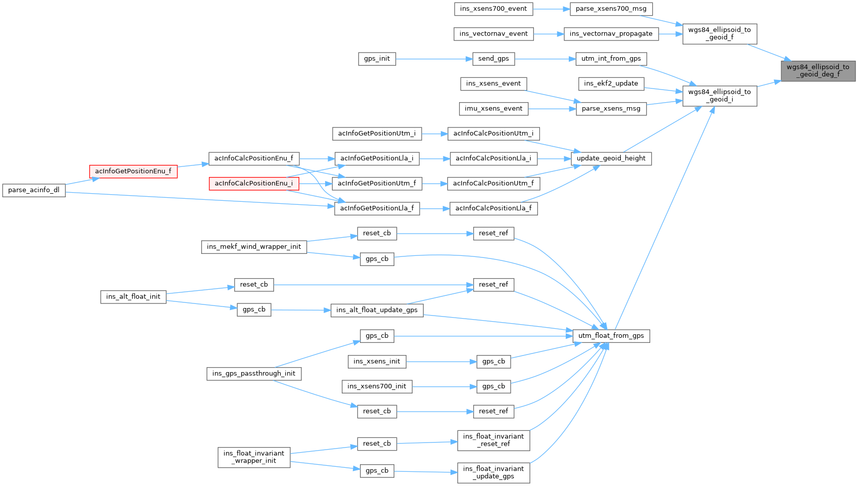
Referenced by wgs84_ellipsoid_to_geoid_f(), and wgs84_ellipsoid_to_geoid_i().
Here is the caller graph for this function:Get WGS84 ellipsoid/geoid separation.
| [in] | lat | Latitude in rad |
| [in] | lon | Longitude in rad |
Definition at line 116 of file pprz_geodetic_wgs84.h.
References foo, and wgs84_ellipsoid_to_geoid_deg_f().
Referenced by ins_vectornav_propagate(), and parse_xsens700_msg().
Here is the call graph for this function: Here is the caller graph for this function:Get WGS84 ellipsoid/geoid separation.
| [in] | lat | Latitude in 1e7deg |
| [in] | lon | Longitude in 1e7deg |
Definition at line 106 of file pprz_geodetic_wgs84.h.
References foo, and wgs84_ellipsoid_to_geoid_deg_f().
Referenced by ins_ekf2_update(), parse_xsens_msg(), update_geoid_height(), utm_float_from_gps(), and utm_int_from_gps().
Here is the call graph for this function: Here is the caller graph for this function:Definition at line 52 of file pprz_geodetic_wgs84.h.
 1.9.8
1.9.8